Cougar Creek Canmore Real Estate
Cougar Creek Canmore explained for buyers: the sunny-side family neighbourhood north of the highway, what homes cost, the 2013 flood and the 34-metre debris-flood retention structure that now protects it, schools and trails.
- Sun exposure
- sunny side
- Short-term rentals
- residential only
- Property mix
- Detached homes, duplexes and townhomes; older stock with renovations
- Suits
- Families, Value seekers
- Cougar Creek is one of the two neighbourhoods where families most often find a detached home in Canmore; the other is Peaks of Grassi across the valley.
- Sunny side: south-facing, so it keeps winter light longer than the Three Sisters side of town.
- The 2013 flood was a roughly 350–400-year event. The Town’s 34 m retention structure upstream is designed for 300- to 1,000-year events and holds up to 650,000 cubic metres of debris.
- Residential only. No nightly rentals anywhere in the neighbourhood.
- Elizabeth Rummel School, the Elk Run ball diamonds, the Benchlands bike park and free Roam Route 5C are all within the neighbourhood.
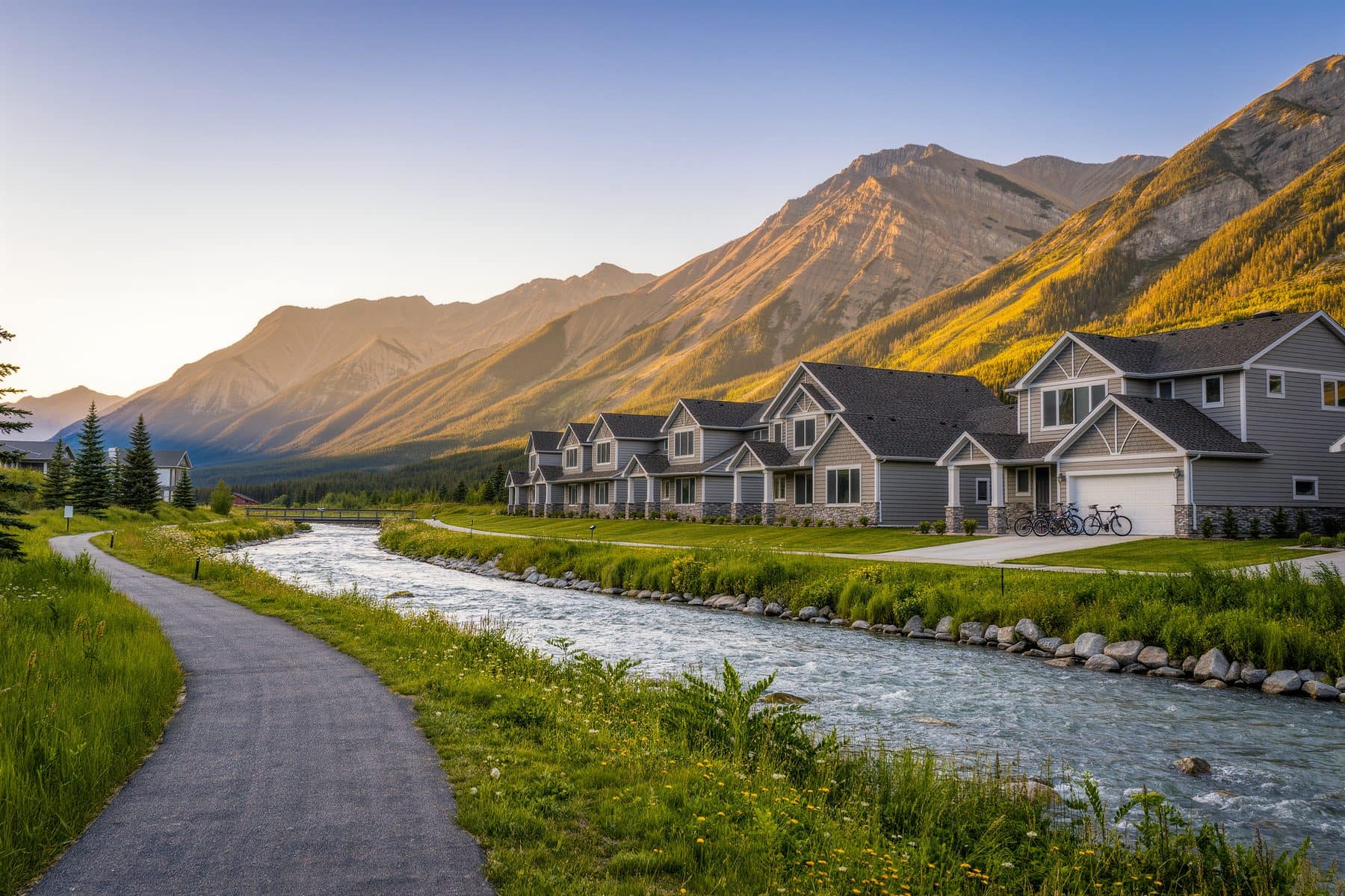
Cougar Creek Canmore is the family neighbourhood on the sunny side of the highway: detached homes and duplexes either side of the creek, an elementary school in the middle, trails at the end of the street. It is also the neighbourhood that flooded in June 2013, and an honest page has to explain what happened and what the Town built since. This page does both, then covers prices, sun, schools and the neighbours to compare.
Where Cougar Creek Canmore sits in the valley and what it feels like
Cougar Creek lies north of the Trans-Canada and Bow Valley Trail, on the alluvial fan where the creek leaves the mountains between Mount Lady Macdonald and Grotto Mountain: bounded by the highway, Elk Run Boulevard's light-industrial area to the east, and the Benchlands and Eagle Terrace hillsides above. Cougar Creek Drive is its spine.
It is a residential grid of 1980s-to-2000s family homes with a lived-in, full-time feel: families with children at Elizabeth Rummel School, Bow Valley workers who want a garage and a yard, and Calgary commuters who value being on the right side of the highway on a winter morning. Few weekenders and few investors, since nothing here can be rented nightly.
Cougar Creek homes for sale: property types and price tiers
| Property type | What you find | Price tier (qualitative) |
|---|---|---|
| Detached homes | Two-storey and bi-level family homes from the 1980s–2000s, attached garages, standard lots; renovated examples command a premium | Mid-market; well below the 2025 town-wide detached average of $2.15M (canmorealberta.com) |
| Duplexes | Side-by-side homes, many original, some rebuilt | Below detached |
| Townhomes | A few complexes on the edges of the neighbourhood | The entry point |
For the town-wide picture see Canmore homes for sale.
The 2013 flood and the debris-flood retention structure
In June 2013 roughly 250 mm of rain fell over three days on ground already saturated by snowmelt. Cougar Creek became a debris flood later estimated by BGC Engineering at a 350- to 400-year return period: it tore out its banks across the developed fan, damaged homes, cut the Trans-Canada and the CP main line, and forced about 1,200 residents to evacuate under a state of local emergency.
- Structure height
- 34 m
- Rock-filled embankment where the creek exits the mountains (Town of Canmore)
- Debris capacity
- 650,000 m³
- Sediment, boulders and trees held back in a flood (AGA project profile)
- Design event
- 300–1,000-year
- Peak flow cut to 45 m³/s (Town of Canmore)
- Built
- 2020–2024
- Planning began after 2013; programme funding over $70M across Canmore’s creeks
What the Town did, in order:
- 12013–2014: short-term worksThe channel across the fan was widened and armoured with articulated concrete mats, and a 40 m wide, 6 m tall debris net was installed at the fan apex to catch up to 20,000 m³ of debris.
- 22014: hazard and risk assessmentBGC identified 190 parcels above the Town’s risk threshold and modelled building-damage scenarios from $8M to $129M; Elk Run Boulevard’s culvert was the likely avulsion point in larger events.
- 32015–2016: option analysis and designAustrian specialists Alpinfra developed three concepts; the Town chose a high retention structure at the Wildland Park boundary over removing homes from the fan. Canadian Hydrotech completed design, an EIA and a Dam Safety review.
- 42020–2024: constructionThe 34 m embankment was built over four seasons, funded by the federal New Building Canada Fund, two Alberta flood programmes and the Town.
The structure is complete. The Town's interactive map carries steep-creek hazard and flood layers for every parcel, the layer to read for any address, because exposure differs by street.
The 2013 hazard maps and the current structure both matter to insurers and lenders. Before you waive conditions, pull the Town's hazard layers for the exact address, ask the seller about flood-related claims or repairs, and get an overland-flood insurance quote in writing.
Buying on the fan: insurance, disclosure and lenders
Since 2013 the practical questions on a Cougar Creek purchase have been less about whether the creek will run again and more about paperwork. Three things are worth doing, in this order.
First, pull the Town's steep-creek hazard and flood layers for the exact parcel before you write an offer rather than after. Exposure on the fan is not uniform. Two houses on the same street can sit differently against the mapped hazard, and those layers are the only public record that tells them apart.
Second, ask your broker during the condition period whether overland flood cover is available at that address, what it costs and what it excludes, and get the answer in writing. A quote that arrives the week after conditions are removed is information you can no longer act on.
Third, tell your lender early. Appraisers and underwriters ask about mapped hazards on this fan, and a file that puts the hazard layer and the completed retention structure in front of them at the start tends to move faster than one where it surfaces late.
None of this makes Cougar Creek Canmore a difficult purchase. The retention structure is built, the channel across the fan was widened and armoured a decade ago, and the neighbourhood has traded normally for years. It does mean the due diligence here carries one step that a purchase in Peaks of Grassi or Riverstone does not.
Sun exposure and winter on the north side
Cougar Creek is on the sunny side: the fan slopes gently south with Lady Macdonald behind it, so the low winter sun crosses the neighbourhood through the middle of the day. Driveways clear faster than in Three Sisters. The trade-off is the creek corridor, which channels cold air on still nights, see the winter in Canmore guide.
Rentals: Cougar Creek is residential throughout. Nightly rental is not permitted, fines start at $2,500, and there are no tourist-home buildings. Long-term rental is allowed, and a tenant living there 183+ days keeps the home out of the Livability Tax.
Schools, trails and amenities
Elizabeth Rummel School (K–4) is at 1033 Cougar Creek Drive. The Elk Run ball diamonds, the off-leash dog park on the 1A, the Benchlands bike skills park and the Cougar Creek trailhead are all on the neighbourhood's edges, and the 3.9 km Benchlands Loop runs up beside Benchlands Trail and back along the creek. Roam Route 5C to town is free. The Canmore schools guide covers where older children go.
A local REALTOR®'s observation from Cougar Creek showings: original 1980s homes and full rebuilds sit side by side, and the difference shows up in heating bills, insurance and inspections more than in listing photos. Budget for the house you are actually buying.
Getting around, and who the neighbourhood suits
The Cougar Creek interchange puts you on the Trans-Canada within a minute or two, which is part of why the neighbourhood keeps its appeal for people who drive into the city two or three days a week; the Canmore to Calgary commute page covers what winter does to that drive. Free Roam Route 5C connects the neighbourhood to the town centre, so a household here can often manage with one car.
It suits three buyers in particular. Families who want a detached house with a garage, a yard and a short walk to Elizabeth Rummel School, and who would rather not pay hillside prices for the same sun. Bow Valley workers who need to be in town year-round rather than at weekends, and who feel the difference the north side makes in February. And hybrid workers splitting the week with Calgary who want quick highway access without a steep driveway.
It suits two buyers badly. Anyone buying for nightly-rental income, because there is none to be had here at any price. And anyone who wants to walk to Main Street for dinner: the highway sits between Cougar Creek and the town centre, so that is a drive or a bus ride rather than a stroll. Downtown Canmore condos and South Canmore are the answer to that one.
How Cougar Creek compares
Eagle Terrace, on the hillside directly above, has the same sun with bigger, newer homes and straight-on Three Sisters views at upper-mid to luxury prices, and steeper driveways. Benchlands Canmore, on the bench beside the interchange, is between the two: elevated views, mid to upper-mid pricing, and the fastest highway access in town. Cougar Creek is the flattest, most walkable-to-school and most attainable of the three.
What this means if you're buying
If you want a detached family home on the sunny side of Canmore with a school you can walk to, Cougar Creek and Peaks of Grassi are the shortlist, and this one wins on light. Pull the hazard layers for the exact parcel, get an insurance quote before you waive conditions, and inspect carefully, the renovation spread is wide. Then look at Eagle Terrace and Benchlands if the budget allows a view.
Where Cougar Creek Canmore sits in the town: the neighbourhoods hub maps all eighteen with prices and buildings.
A local REALTOR® in Canmore can pull both before you book a viewing. Fifteen minutes, free, no obligation.
Frequently asked
Is Cougar Creek in Canmore safe from flooding now?
The Town of Canmore’s debris-flood retention structure, a 34-metre-high rock-filled embankment where the creek leaves the mountains, was completed in 2024. It is designed to hold up to 650,000 cubic metres of sediment and debris and to cut peak flow to 45 cubic metres per second in a 300- to 1,000-year event. Residual risk is never zero; check the steep-creek hazard layer for any specific address on the Town’s interactive map.
What happened in Cougar Creek in the 2013 flood?
Roughly 250 mm of rain fell over three days in June 2013 on saturated ground. Cougar Creek turned into a debris flood estimated at a 350- to 400-year return period, eroded its banks across the developed fan, damaged homes and infrastructure, cut the Trans-Canada and the CP rail line, and forced the evacuation of about 1,200 residents. A state of local emergency was declared.
What do Cougar Creek homes cost?
Mid-market for detached homes in Canmore terms, well below the 2025 detached average of $2.15M (canmorealberta.com), with duplexes and townhomes below that. Much of the stock is 1980s to 2000s and renovation quality varies widely, so two similar houses on one street can differ by a lot. Ask a local REALTOR® for recent sold prices.
Can you Airbnb in Cougar Creek?
No. Cougar Creek is residential throughout. Nightly rental is legal only in tourist-home zoned properties, none of which are here, and the Town fines illegal short-term rentals from $2,500. Long-term rental is permitted, and a full-time tenant keeps the home out of the Livability Tax.
Which schools are in Cougar Creek?
Elizabeth Rummel School, the public K–4 school, is at 1033 Cougar Creek Drive. Older public students go to Lawrence Grassi Middle School (5–8) on 7th Avenue and Canmore Collegiate (9–12) on 8th Avenue, both across the highway on the valley floor; Roam Route 5C connects the neighbourhood to town for free.
- Town of Canmore: Flood Mitigation (Cougar Creek structure, funding, other creeks)
- Camiré & Esarte, Town of Canmore: Cougar Creek’s Debris Flood Retention Structure: Our Path to Risk Reduction (GeoHazards 7, 2018)
- American Galvanizers Association: Cougar Creek Debris Flood Retention Structure project profile
- Town of Canmore: Interactive Community Map (steep-creek hazard and flood layers)
- Canadian Rockies Public Schools: Schools (Elizabeth Rummel School)
- Town of Canmore: Parks, Playgrounds and Sport Fields
- Town of Canmore: Roam transit in Canmore
- canmorealberta.com: Canmore real estate 2025: a return to balance
Keep reading

Tell us what you’re looking for and get a straight answer, usually the same day.