South Canmore Homes for Sale
South Canmore homes for sale explained for buyers: the flat, walkable streets between downtown and the Bow River, why it has the highest average prices in town, what the original bungalows and $3M rebuilds sell for, and who it suits.
- Sun exposure
- valley floor
- Short-term rentals
- residential only
- Property mix
- Detached homes, infill duplexes and a few small condo buildings
- Suits
- Luxury buyers, Walkers
- The most walkable detached neighbourhood in Canmore: Main Street, Riverside Park, the Bow River loop and Lawrence Grassi Middle School are all on foot.
- Highest average prices in town (≈ $1.65M, Zolo, August 2026) because it is almost all detached homes on flat lots minutes from downtown.
- Wide spread of stock: original 1970s bungalows, tasteful renovations, infill half-duplexes and full rebuilds, lot value drives everything.
- Residential only. No nightly rentals.
- Check the Town’s flood-mapping layer for any property near the Bow River or Policeman’s Creek before you offer.
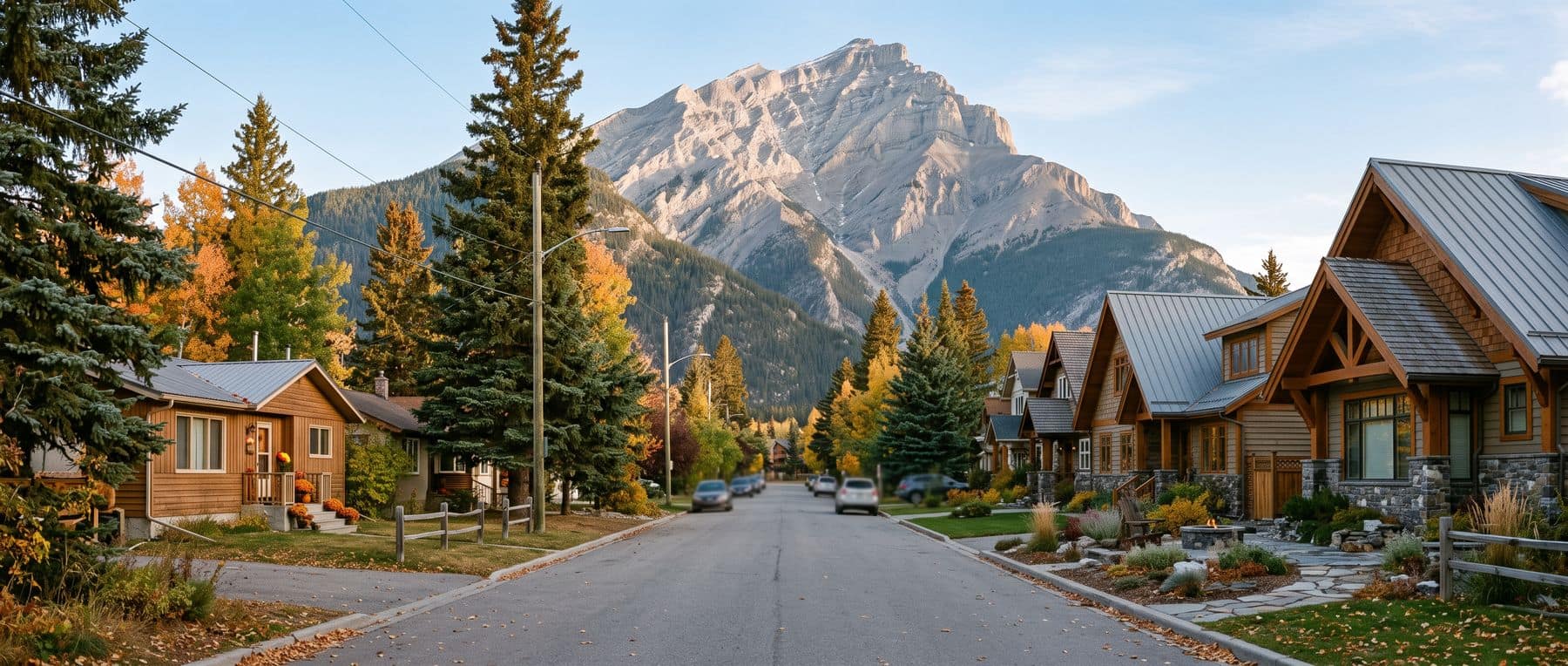
South Canmore homes for sale are the most expensive in town on average, and the reason is simple: it is the only neighbourhood where you can own a detached house on a flat lot and walk to everything. The streets between Main Street and the Bow River are old, treed and quiet, and the houses on them range from untouched 1970s bungalows to $3M rebuilds. This page covers the location, the stock, the prices, the river and how it compares with Downtown and Spring Creek.
Where South Canmore homes for sale sit, and what the streets feel like
South Canmore is the grid of streets south of Main Street (8th Street), running down to the Bow River and bounded on the east by Policeman's Creek and the Spring Creek community. It is the original townsite: the Canmore Museum records that the coal company built housing and the Model School here during the mining era, which ran from the first mine in 1887 to closure on 13 July 1979.
The feel is a small-town residential neighbourhood that happens to be one block from a resort main street: mature spruce and aspen, sidewalks, short blocks, and the river path at the end of them, with Riverside Park at 600 River Road as the front lawn. Who lives here: long-time Canmore families in the original houses, professionals and retirees who bought or built for walkability, and a growing share of well-funded second-home owners in the rebuilds.
South Canmore homes for sale: property types and price tiers
| Property type | What you find | Price tier (qualitative) |
|---|---|---|
| Original detached homes | 1970s bungalows and split-levels on mature lots, some renovated, some untouched | Around and above the neighbourhood average of about $1.65M (Zolo, August 2026); lot value sets the floor |
| Rebuilds and new custom homes | Contemporary mountain homes replacing originals, often with legal suites | $3M and up |
| Infill half-duplexes | Newer side-by-side homes on subdivided lots | Upper-mid; the neighbourhood's entry point |
| Small condo buildings | A handful on the edges | Upper-mid |
Zolo's August 2026 average of about $1.65M for South Canmore is the highest of any Canmore neighbourhood. The luxury homes in Canmore page covers the rebuild end; sold prices tracks recent sales by neighbourhood.
In South Canmore the land is most of the price. An original bungalow and a lot-value teardown can list within a few hundred thousand of each other, and a "renovated" house may be a 1970s structure with new finishes. Get a thorough inspection, ask about the foundation and services, and think about whether you are buying a house to live in or a site to build on, the two are priced differently.
Sun exposure and winter on the valley floor
South Canmore is flat and open, with no hillside behind it, so it gets the low winter sun across the middle of the day, more than the south-side neighbourhoods at the base of Rundle, less than Silvertip's slope. Mature trees shade some lots in summer and shed light in winter. Driveways are flat, which is a real advantage in January, and the river corridor brings cold air and fog on still nights. The winter in Canmore guide covers the day-to-day.
Short-term rentals: residential only
South Canmore is residential throughout. Nightly rental is not permitted, there are no tourist-home buildings, and the Town of Canmore fines illegal short-term rentals from $2,500, long-term rental, including of a legal suite, is allowed, and a full-time tenant keeps a property out of the Livability Tax. The Town Centre Area Redevelopment Plan, adopted 8 July 2025 under Bylaw 2025-05 and revised on 2 December 2025, applies to downtown, not to South Canmore's residential streets: its plan area runs to the Bow River on the west, the Spur Line Trail on the north and Centennial Park on the south, and the plan's own map labels South Canmore as an adjacent area outside the boundary, which on that side follows 5 Street.
The river, the park and what is nearby
- Riverside Park
- 600 River Road
- River and mountain views, picnics and weddings (Town of Canmore)
- Lawrence Grassi Middle School
- Grades 5–8, 610 7th Avenue
- Walkable from every South Canmore street (CRPS)
- Main Street
- One block north
- Seasonal pedestrian zone, restaurants, shops
- Flood mapping
- Parcel by parcel
- Town interactive map carries flood, setback and steep-creek layers
The Bow River pathway runs along the neighbourhood's edge, Elevation Place and Canmore Collegiate are a short walk or bike north-west, and Spring Creek's restaurants are across the footbridge. The river is the neighbourhood's best feature and its one caution: check the Town's flood-mapping layer for any address near the water.
A local REALTOR®'s South Canmore habit is to walk the lane behind a house: it shows the lot depth, the garage, whether a suite has its own entrance, and how much of the block has already been rebuilt. It is the quickest read on what the street will look like in ten years.
Who South Canmore suits, and how it compares
It suits buyers who want a detached home and a walkable life and can pay for both, families who want children walking to school, and anyone planning to build. It does not suit buyers who need a hillside view, a large lot, a lock-and-leave condo, or nightly-rental income, and it is not the place to look for value.
Downtown Canmore, one block north, is the condo version of the same walkability at lower entry prices, with the noise and visitors of Main Street. Spring Creek Canmore, across Policeman's Creek, is the newer condo alternative: lodge buildings, geothermal heating, condo fees, and two buildings that allow nightly rental. South Canmore is the only one of the three where you own the land.
What this means if you're buying
South Canmore homes for sale ask you to pay for the lot and the walk, and they carry the highest average prices in town. Decide whether you are buying a house or a site, inspect the original structures carefully, check the flood layer and get an insurance quote for anything near the river, and run the full carrying cost, property tax on a seven-figure assessment, plus the Livability Tax if you live outside Alberta, through the buyer cost calculator. Then compare with Downtown and Spring Creek before you settle on the detached premium.
To see how South Canmore prices sit against the rest of the town, start with Canmore homes for sale.
For prices by area and which neighbourhoods allow nightly rental, the neighbourhoods comparison has the table, and it is the quickest way to set South Canmore homes for sale beside the detached, condo and tourist-home options everywhere else in the valley.
A local REALTOR® can send the last year of sold prices for homes here and flag which lots have been rebuilt. Free fifteen-minute call.
Frequently asked
Where is South Canmore?
The streets south of Main Street (8th Street) between the Bow River on the west and south and Policeman’s Creek and the Spring Creek community on the east. It is the original town grid, and coal-company housing and the town’s Model School were built here in the mining era, according to the Canmore Museum.
Why is South Canmore so expensive?
Because it combines the three things Canmore buyers pay most for, flat lots, walking distance to Main Street and the river, in a neighbourhood that is almost entirely detached homes and cannot grow. Every sale is either a scarce original house or a rebuild on a scarce lot. Zolo put the average at about $1.65M in August 2026, the highest in town.
What is South Canmore real estate like?
A mix. Original 1970s bungalows and split-levels on mature treed lots sit beside infill half-duplexes and new custom homes at $3M and above. Prices are driven by the lot as much as the house. There are a few small condo buildings on the edges but no large complexes.
Can you Airbnb in South Canmore?
No. South Canmore is residential; nightly rental is only legal in tourist-home zoned properties and the Town of Canmore fines illegal short-term rentals from $2,500. Long-term tenancy is permitted, and a full-time tenant keeps the home out of the Livability Tax. Hotels and licensed visitor accommodation are in the downtown and Bow Valley Trail districts, not here.
Is South Canmore in a flood zone?
Parts of it are close to the Bow River and Policeman’s Creek, and the Town of Canmore’s interactive map carries flood-mapping and setback layers for every parcel. Some addresses are affected and some are not; check the exact property, ask your insurer for an overland-flood quote, and read the seller’s disclosure before you waive conditions.
- Zolo: Canmore real estate trends (South Canmore average, August 2026)
- Canmore Museum: Canmore’s mining heritage (South Canmore company housing and Model School)
- Town of Canmore: Parks, Playgrounds and Sport Fields (Riverside Park)
- Canadian Rockies Public Schools: Schools (Lawrence Grassi Middle School)
- Town of Canmore: Interactive Community Map (flood mapping and setback layers)
- MyCanmore: Connect Downtown: Town Centre Area Redevelopment Plan (adopted 8 July 2025)
- Town of Canmore: Town Centre Area Redevelopment Plan, Bylaw 2025-05, adopted 8 July 2025 (plan area map, Figure 2.1)
- Town of Canmore: Accommodation Types
Keep reading

Tell us what you’re looking for and get a straight answer, usually the same day. Free, and no obligation.