Canmore Zoning Map: How to Read It
The Canmore zoning map explained: how to look up any parcel's land use district, hazard overlays and assessment code on the Town's interactive map.
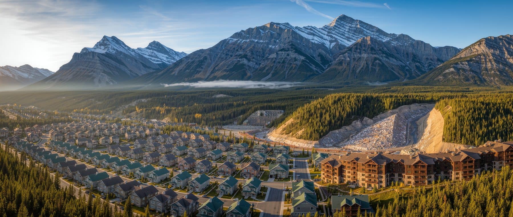
- The live map is the authoritative version. There is no current town-wide zoning PDF: the district maps sit in Section 15 of Land Use Bylaw 2018-22, and the web map is what the Town maintains.
- The parcel pop-up carries two different things people confuse. Land Use District is the zoning; Assessment Code is the tax class, and class 21 is Tourist Home.
- The Town publishes 329 land use district polygons carrying 100 distinct district codes, of which 54 are one-off Direct Control districts written for a single site.
- Overlays beat districts. Land Use Bylaw section 7.1.0.1 says the underlying district is subordinate where it conflicts with an overlay, so a Steep Creek or Sub-Surface Hazard layer can remove building rights the district appears to grant.
- No zoning map anywhere shows whether a specific unit holds a tourist home development permit. Only the Town's Planning department can confirm that.
The Canmore zoning map is not a PDF you download, it is a web application you operate. The Town's Interactive Community Map holds the zoning, and the answer you want sits inside a pop-up you have to know how to open. Turn on the Land Use Districts layer, click the parcel, and the pop-up returns the district code, the assessment code, the roll number and the legal address. This is the operating manual: what to click, what each field means, which one decides whether you can rent nightly, and which layers to switch on before you offer on a lot.
Where to find the Canmore zoning map
It lives on canmore.ca under Residential Services, as the Interactive Community Map. It is built in ArcGIS and replaced the old Property Information Viewer when that software was retired, and the Town calls it "a publicly accessible, one-stop shop [that] provides maps and GIS information for the Town of Canmore." Zoning is not the front page of it. Zoning is one layer among several dozen, grouped by theme.
| Layer group | What is inside it | The question it answers |
|---|---|---|
| Planning and Land Use | Land Use Districts, Area Structure Plans, Area Redevelopment Plans, Offsite Levy Zones, Habitat Patch, Wildlife Corridor, Railway Setbacks (30 m and 27.5 m) | What district is this, and what plan sits over it? |
| Flood | Provincial floodway, flood fringe, cross sections, overland flow elevations, 1:100 year design groundwater elevations | Will the province's flood mapping constrain a basement or a rebuild? |
| Steep Creeks | Steep Creek Hazards, Steep Creek Study Areas, Forensic Hazard and Risk Reports | Is this lot on a debris fan? |
| Undermining | Undermining Review Regulation Designated Land, Undermining Reports | Does a coal-mine assessment stand between this lot and a development permit? |
| Property | Property ID, Legal Address, Civic Address, Land Use District, Lot Footprint, Assessment Value, Assessment Code, Roll Number | Who and what is this parcel, on the roll? |
| Basemaps | Canada Topographic Map, Orthophoto 2022, Orthophoto 2025 | What was actually built here, and when? |
Evacuation Zones and Civic Addresses sit alongside those. The district polygons will not draw until you expand the group and tick the layer, which is why plenty of people open the map, see an aerial photograph of Canmore and close it again.
The map also stops at the town boundary. Harvie Heights, Dead Man's Flats, Exshaw and Lac des Arcs are hamlets in the MD of Bighorn, zoned under its own Land Use Bylaw 10-26, which replaced Bylaw 09-Z/18 on 13 July 2026 and cut 32 districts down to 18. Search one of those addresses and the Canmore zoning map returns nothing, which is not the same as unzoned land. The rules out there are different in ways that matter: the new Bighorn bylaw allows no short-term rental at all in Harvie Heights airbnb, while Dead Man's Flats airbnb has buildings that do carry nightly rental.
How to look up a property's zoning in four clicks
- 1Search the civic addressUse the search box, not the map pan. Canmore has repeating street names across neighbourhoods and a mistyped number will land you on the wrong side of a district boundary.
- 2Open the layer list and tick Planning and Land Use, then Land Use DistrictsThe group has to be expanded before the child layer will draw. Coloured polygons appear over the parcels with their codes labelled at closer zoom levels.
- 3Click the parcel itself, not the buildingThe pop-up is tied to the parcel polygon. On a condominium plan you may get a stack of results to page through, one per unit.
- 4Read the pop-up fieldsLand Use District is the zoning. Assessment Code is the tax class. Roll Number identifies the tax account. Legal Address is the plan, block and lot your lawyer will use.
Two habits save you time. Zoom in before you click, because district boundaries follow lot lines and road centre lines and at low zoom you cannot tell which side of one you are on. On a condominium plan expect a stack of pop-up results to page through, one per unit, so check that the one you are reading is the unit you are buying. And read the district boundary rules if a parcel looks split: Land Use Bylaw section 15.2 says a boundary shown along a roadway follows the centre line, a boundary next to a lot line is the lot line, and where a boundary divides a lot the line is fixed by survey.
What the district codes on the Canmore zoning map mean
The codes are compressed, but they group into families. The Town's own published layer carries 329 district polygons and 100 distinct district codes across the townsite.
| Code family | What it covers | Examples from the Town's layer |
|---|---|---|
| R1 to R5 | Residential, from single family-detached through two-unit, comprehensive multiple unit, medium density and apartment | R1, R1A, R1B, R1B-W, R1NM, R2, R2A, R3, R4, R5 |
| STR-1, STR-2 | The two Silvertip residential districts | Silvertip Residential Single Family and Two Unit; Silvertip Comprehensive Residential |
| TSMV and SC suffixes | Three Sisters Mountain Village and Stewart Creek variants, often with density and building-height numbers baked into the label | R3 TSMV d50 b74, R4 TSMV d68 b110, R2A-SC, R3-SC1 |
| Commercial and mixed use | Town centre, the Bow Valley Trail corridor, gateway, resort and local commercial | TC, CC, CRD, BVT-C, BVT-G, BVT-T, GD, GD-2, MU-T, TPT-CR, TS-GD, TS-MU |
| Miscellaneous | Employee housing, manufactured homes, business and industrial transition, industrial, visitor services, parks, conservation, future development | EHD, MHR, SB, TBD, TID, IND 1, IND 2, VIC, NP, CW, ED, FD, PD |
| DC | Direct Control districts, each written for one site | Van Horne, Spring Creek Mountain Village, Palliser Lane Perpetually Affordable Housing, Canmore Hotel |
That last row is the one buyers skip. Of the 100 codes, 54 are Direct Control. If your parcel returns a DC code, the standard R or C rules in the bylaw do not govern it: a bespoke section of Land Use Bylaw 2018-22 does, written for that development, and you have to read it. The Land Use Bylaw for buyers post explains permitted against discretionary uses inside whichever district you land in.
Land use district versus assessment code: the distinction that decides short-term rental
These are two different pieces of information in the same pop-up, and confusing them is the most expensive mistake this map produces. The Land Use District is zoning: what the bylaw contemplates for that land. The Assessment Code is the tax class the assessor has applied to that specific property this year. The Town's own accommodation-types page tells people to click the property on the interactive map and read the roll number code under the annual assessment to work out how it is classed, and its tourist-homes page confirms a tourist home is a residential sub-class carrying the class 21 assessment code.
So the district tells you what is theoretically possible on that land. The assessment code tells you how the Town is taxing this unit now. Neither is a permit. Land Use Bylaw section 1.8.0.2 is explicit: "A Tourist Home constitutes a separate and additional development of a Dwelling Unit and requires a Development Permit for its operation." A parcel can sit in a district where tourist homes once existed and hold no permit at all.
Since 11 March 2025 Tourist Home is no longer a permitted use in Canmore's established residential districts. It remains permitted only in Silvertip's STR-1 and STR-2 districts and on the Three Sisters Village parcels identified in that Area Structure Plan. Existing tourist homes keep their status, and conversion to residential is one-way and fee-free to 31 December 2026. None of that shows on the zoning map: the district polygons look exactly as they did before the amendment.
The map draws districts. Nightly rental depends on three things it does not draw: a development permit for tourist home use on that unit, a current business licence, and the condominium corporation's bylaws, which can prohibit what the Town allows. Check the assessment code for class 21, then ask Planning to confirm the permit, then read the condo documents. Tourist home versus residential versus visitor accommodation sets out the three categories.
The overlay layers most buyers never switch on
Switch these on before you offer on a lot, because in Canmore an overlay can remove a building right the district appears to grant. Land Use Bylaw section 7.1.0.1 says overlays and districts are read together, "but the underlying district is considered subordinate when there is a discrepancy between the two districts." The overlay wins.
- Steep Creek Hazards and Steep Creek Study Areas. In an Extreme or High Hazard Zone the bylaw allows only a short list of uses: accessory building, extensive agriculture, outdoor athletic and recreational facility, bed and breakfast, home occupations, open space, public utility, sign, wildlife corridor and habitat patch. Existing buildings can still be repaired, renovated, decked and added to under section 7.8.1.1, provided the addition brings no new windows or doors at grade and does not intensify the use, but a new dwelling is not on that list. The bed and breakfast exception is itself suspended in the high hazard flood season, 15 May to 30 June each year.
- Undermining Review Regulation Designated Land. On designated undermined land, the Canmore Undermining Review Regulation (AR 34/2020, in force 1 April 2020) requires an engineer's undermining assessment report and compliance certificate before the Town issues a development permit. Separately, the bylaw's Sub-Surface Hazards Overlay is blunter: except for public utilities, no new buildings are permitted inside it.
- Provincial floodway and flood fringe. Provincial mapping, not municipal, and it drives insurability as much as approvability.
- Wildlife Corridor and Habitat Patch. These constrain fencing, lighting and site layout on the edges of several neighbourhoods.
- Railway Setbacks, 30 m and 27.5 m. A thin band along the CP line through town that quietly shrinks a buildable envelope.
- Offsite Levy Zones. Not a hazard, but the only place the cost of building is mapped, so switch it on with the rest. Under Bylaw 2020-27 most zones run $6,700 to $11,000 per residential unit and two exceed $20,000.
If you are buying land rather than a house, read this alongside building in Canmore.
The basemap list holds both a 2022 and a 2025 aerial. Flip between them on the same parcel. A deck, a garage, a suite entrance or a dormer that exists in 2025 and not in 2022 tells you roughly when the work happened, which is exactly the question to put to the seller: was there a development permit, and is there a current compliance stamp? It is worth doing before writing an offer on any older Canmore house, because an unpermitted addition surfaces at the compliance stage and delays possession.
What the Canmore zoning map cannot tell you
It is a planning reference, not a legal instrument. It does not show whether a development permit was ever issued or is still valid, whether a building sits inside its setbacks, whether an addition was permitted, what a condominium corporation's bylaws prohibit, or what a Direct Control bylaw actually says beyond naming it. The Town also puts a reproduction notice on the map: it "may not be reproduced, in whole or in part, in any form or by any means without written permission of the Town of Canmore."
Two documents do the jobs the map cannot. A Real Property Report with a municipal stamp of compliance shows the structures surveyed against the setbacks, at $113 per residential unit for the stamp under the Town's 2026 fee schedule. And a written confirmation from Planning and Development, reachable on 403.678.1500, is the only binding answer on use and permits. Get both before conditions come off.
Is there a Canmore zoning map PDF, and can I download the data?
There is no current standalone town-wide PDF, but the bylaw carries maps. Land Use Bylaw 2018-22 includes Section 15, Land Use District Maps, and each development overlay in Section 7 has its own figure map. The catch is on the bylaw's own cover: it is an office consolidation and it "has no legislative sanction". The version in circulation lists 39 amending bylaws since 2018, and four of them came into force on a single day, 30 June 2026: the Town Centre Area Redevelopment Plan implementation, two new Direct Control districts, among them Amendment 2026-01 creating the Lands Adjacent to Tînda Mîmun Direct Control District, and a change to appeal board notification. The live map is what the Town keeps current.
The data itself is downloadable and the licence is generous, which surprises people who read the map's reproduction notice. The Town publishes Canmore Land Use Districts on its ArcGIS open data portal, described as "polygons showing the boundary of Land Use Districts, also known as zoning", last updated 12 August 2026, offering CSV, Shapefile, GeoJSON, KML and a GeoServices REST endpoint. The attribute table is two fields, LUC_CODE and DESCRIPTIO. The Town of Canmore Open Data Licence grants a worldwide, royalty-free, perpetual licence including for commercial purposes, on condition you attribute it: "Contains information licensed under the Town of Canmore Open Data Licence." It excludes personal information and the Town's names, crests and logos.
What the assessment code costs you in 2026 property tax
The assessment code sets the rate, not the district. Two identical R1 houses on the same street can pay 0.457% and 0.833%, because the residential split is decided by the housing declaration the owner files by 31 December, not by anything drawn on the map. A primary resident is someone living there at least 183 days in the year, including at least 60 consecutive days. Miss the declaration and the higher rate applies by default. These are the Town's 2026 all-in rates, municipal plus provincial education plus the seniors requisition plus the Vital Homes levy.
- Primary residence
- 0.457%
- $5,479 a year on a $1.2M assessment
- Residential, non-primary
- 0.833%
- $10,002 on the same $1.2M. The Livability Tax delta is 0.377%
- Tourist home (class 21)
- 0.832%
- Non-residential municipal rate, residential education rate
- Non-residential, including visitor accommodation
- 0.957%
- Hotel condos sit here
A tourist home and a non-Albertan's second home now pay almost identical all-in tax. Model your own number with the property tax calculator, and read Canmore property tax for how the classes and deadlines interact.
What this means if you are buying
Use the Canmore zoning map as your first filter, never as your last word. Look the parcel up, note the Land Use District and the Assessment Code separately, and switch on Steep Creek, flood, undermining and railway setbacks before you decide a lot is buildable. If the code starts with DC, find and read that Direct Control section of the bylaw. Then, before conditions come off, get Planning's written confirmation of the use and any tourist home development permit, and an RPR with a compliance stamp. The map narrows the question. Only the Town closes it.
Send us the address. Our partner realtor will pull the parcel on the Canmore zoning map, read the district code against the assessment code, and tell you what still needs confirming with the Town. Free, no obligation.
Frequently asked
Where is the Canmore zoning map?
On canmore.ca, under Residential Services, as the Interactive Community Map. It is an ArcGIS web application that replaced the retired Property Information Viewer, and the Town describes it as a publicly accessible one-stop shop for maps and GIS information. Zoning sits inside the Planning and Land Use layer group as Land Use Districts. The underlying rules live in Canmore's Land Use Bylaw.
Is there a Canmore zoning map PDF?
Not as a current standalone town-wide download. Land Use Bylaw 2018-22 contains Section 15, Land Use District Maps, and Section 7 carries a figure map for each development overlay. But that bylaw is an office consolidation with no legislative sanction, and the version in circulation lists 39 amending bylaws since 2018. A PDF is a snapshot of a bylaw that moves several times a year, so the live web map is the version the Town keeps current.
How do I find the zoning of a property in Canmore?
Open the Interactive Community Map, search the civic address, turn on Planning and Land Use then Land Use Districts, and click the parcel itself rather than the building on it. Zoom in first: section 15.2 puts district boundaries on road centre lines and lot lines, so at low zoom you cannot tell which side of one your parcel sits on. Before an offer goes firm, confirm the result with the Town's Planning and Development department on 403.678.1500.
Is there a Canmore short-term rental zoning map?
No, and a district map could not be one. Since 11 March 2025 Tourist Home is no longer a permitted use in Canmore's established residential districts. It remains permitted only in Silvertip's STR-1 and STR-2 districts and on the Three Sisters Village parcels identified in that Area Structure Plan. Even inside those districts, nightly rental needs a development permit on that unit. See tourist home zoning.
What does R1 mean on the Canmore zoning map?
R1 is the Residential Single Family-Detached District. The Town's own layer also carries R1A under the same description, plus R1B Residential Single Family-Detached Plus and its E, W and SC variants, and R1NM for narrow Moraine Road lots. The letter tells you the built form the district contemplates, not what is standing on the lot today or what a development officer would approve.
Does the Canmore zoning map show property assessments?
Yes. The Property layer returns Assessment Value and Assessment Code alongside the roll number, which is why the Town's accommodation-types page tells people to read the roll number code to work out how a property is classed. That is the tax class, not the zoning. The two answer different questions, and Canmore property assessment explains how the value itself is set.
- Town of Canmore: Interactive Community Map (layer list, parcel fields, reproduction notice)
- Town of Canmore: Revised Land Use Bylaw 2018-22, office consolidation (sections 1.8, 1.16, 7.1, 7.6, 7.8, 15)
- Town of Canmore Open Data: Canmore Land Use Districts layer
- Town of Canmore: Accommodation Types
- Town of Canmore: Tourist Homes (class 21 assessment code)
- Town of Canmore: Taxation Rates for 2026
Keep reading

Tell us what you’re looking for and get a straight answer, usually the same day.